Surprise sits at an elevation of roughly 1,175 feet, with subsurface profiles dominated by caliche, stiff clay, and pockets of loose sandy alluvium washed down from the White Tank Mountains. In our lab, we see these materials behave very differently once a cut goes deeper than 8 or 10 feet. Caliche looks solid but can fracture in slabs without warning, and the sandy lenses drain fast, pulling fine particles behind the lagging. We run test pits early in the job to map where those transitions happen, then design the monitoring array to match the real stratigraphy. When the excavation stays open for weeks under Arizona sun, we track lateral movement with inclinometers, load cells on tieback anchors, and optical survey points on the shoring face. The goal is not just to collect data—it is to give the superintendent a clear threshold: if a reading exceeds the trigger value, the crew knows exactly what to do before the shift ends.
A stable reading at noon in August does not mean the wall is stable at midnight—thermal cycles in the desert mask real movement.
Technical details of the service in Surprise Arizona
Local geotechnical conditions in Surprise Arizona
With a population approaching 160,000 and development pushing farther into the western valley, Surprise sees deeper excavations for stormwater detention, multi-story parking, and commercial baselines that did not exist here a decade ago. The main risk is not a sudden collapse—it is a slow, unnoticed displacement that kinks a water main, tilts a retaining wall, or cracks the slab of an adjacent fire station. We have seen cases where a four-inch lateral movement went undetected for three weeks because nobody was reading the prisms, and the contractor assumed the clay would self-heal. It does not. By the time cracks appear at surface, the damage behind the wall is already done. Monitoring is the only way to catch that progression while it is still reversible.
Our services
We run the monitoring program as a standalone scope or integrated with the geotechnical investigation, depending on the project phase. In Surprise, the most common requests from contractors and shoring designers are:
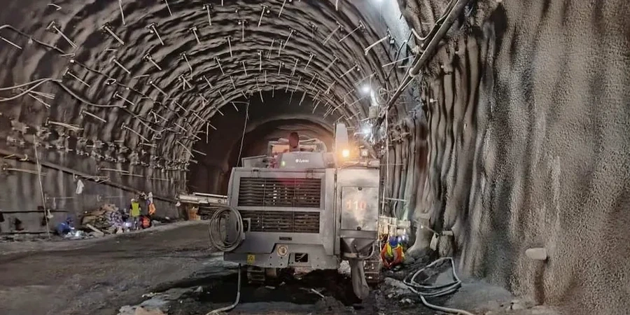
Inclinometer casing and reading
Vertical casings installed behind the shoring wall or in the retained zone. We read them with a digital probe on a fixed schedule and plot cumulative deflection versus depth.
Tieback anchor load monitoring
Center-hole load cells installed on selected anchors. We track load drift during excavation, lock-off, and long-term hold periods to verify design assumptions.
Optical survey and crack mapping
Prisms mounted on the wall face and on adjacent structures. Crack gauges placed across existing fissures in nearby slabs or walls to detect movement as small as a few thousandths of an inch.
Vibration monitoring during shoring installation
Seismographs placed at the nearest sensitive structure while drilling soldier piles or driving sheet piles, with real-time alerts if particle velocity exceeds the IBC threshold.
Common questions
What does geotechnical excavation monitoring cost in Surprise?
Monitoring programs in Surprise typically range from US$840 to US$2,650 depending on the number of instruments, reading frequency, and project duration. A basic setup with three inclinometer casings, a few load cells, and weekly readings falls at the lower end. A full program with daily readings, multiple prisms, crack gauges, and vibration monitors over several months runs higher. We provide a fixed-price quote after reviewing the shoring plan and site access conditions.
How often do you take readings during excavation?
During active excavation, we read instruments daily, always at the same time window to minimize thermal noise. Once the cut reaches final grade and the wall is stable for five consecutive readings, we drop to weekly or biweekly intervals. If we see an accelerating trend, we go back to daily readings and notify the contractor immediately.
Which instruments work best in caliche and stiff clay?
Inclinometers and optical prisms perform well in Surprise soils. Caliche can be abrasive during casing installation, so we use flush-coupled, grooved casing to avoid kinks. Load cells on tiebacks are effective in clay because they capture the load redistribution that happens as the soil creeps. Crack gauges on adjacent slabs are essential when the excavation is within 15 feet of an existing building.
What triggers a stop-work or alert?
We set trigger values during the pre-construction meeting, based on the shoring designer's allowable deflections and the IBC deformation limits for adjacent structures. A typical lateral movement trigger is 0.5 inches or 80 percent of the design allowable, whichever is smaller. If a reading hits that threshold, we send an alert within the hour and recommend a visual inspection before the next shift.